
Loowit Trail, Day 1, 7/3/2018
The day started bright and early at 6:30 am. We had a long way to go to get to St. Helens, and then I had a long walk after that to get to the first camp site.
David and I made great time and arrived at the Johnston Ridge Observatory (JRO) just after 10:00. We scarfed down some sandwiches he made in the morning (wow, a ride AND a meal!) and I said my goodbyes in the chilly wind – but sunny skies.
Many many thanks goes out to David for the ride – and David and Jodie for hosting me at their place without hesitation. And plus they gave me just the right amount of space. Wow, perfect friends. Thank you!
And thank you’s going out, I’d be remiss to not also give my heartfelt appreciation to my wife for handling the shuttle, the resupply packages and willingness to let me back into the family life unexpectedly so I can recoup. Thank you, love.
There is a saying on the PCT that says:
The number of days required to re-acclimate to trail life = the number of days you left the trail – 1
In other words, one day of rest – sure, great. But each day thereafter is another day of trying to get your groove back.
I thought of this quite firsthand as I said my farewells to David. My desire to go hike 12 miles with an even heavier pack was about zero. But I pushed through, knowing that there was a reason I was there, and the person making me be there and pursuing that reason was none other than myself.
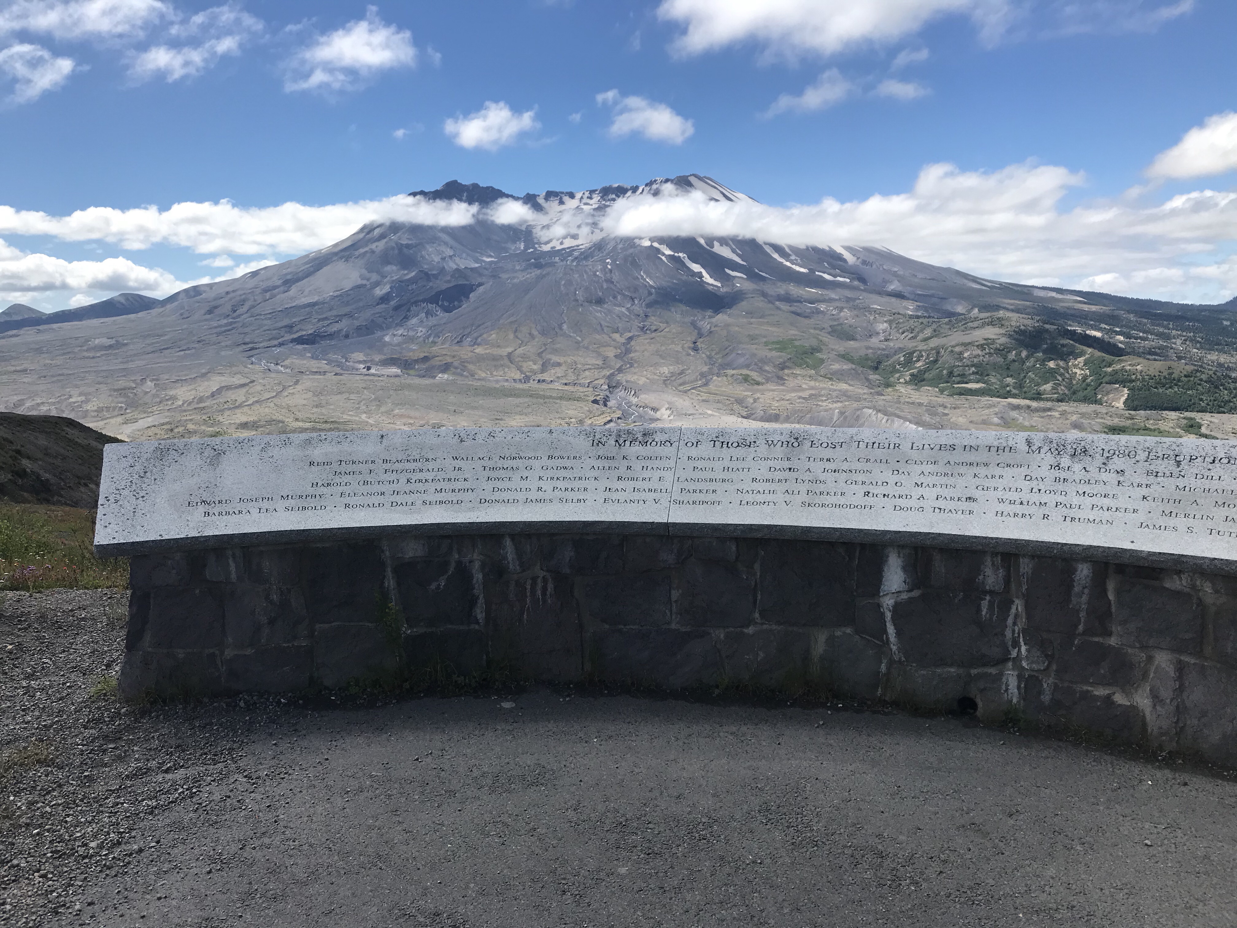
The trail headed up and then down into the plains of the blast zone. This memorial near the beginning the trail capture this list of all the names of lives lost in the eruption – much more than I thought it was.
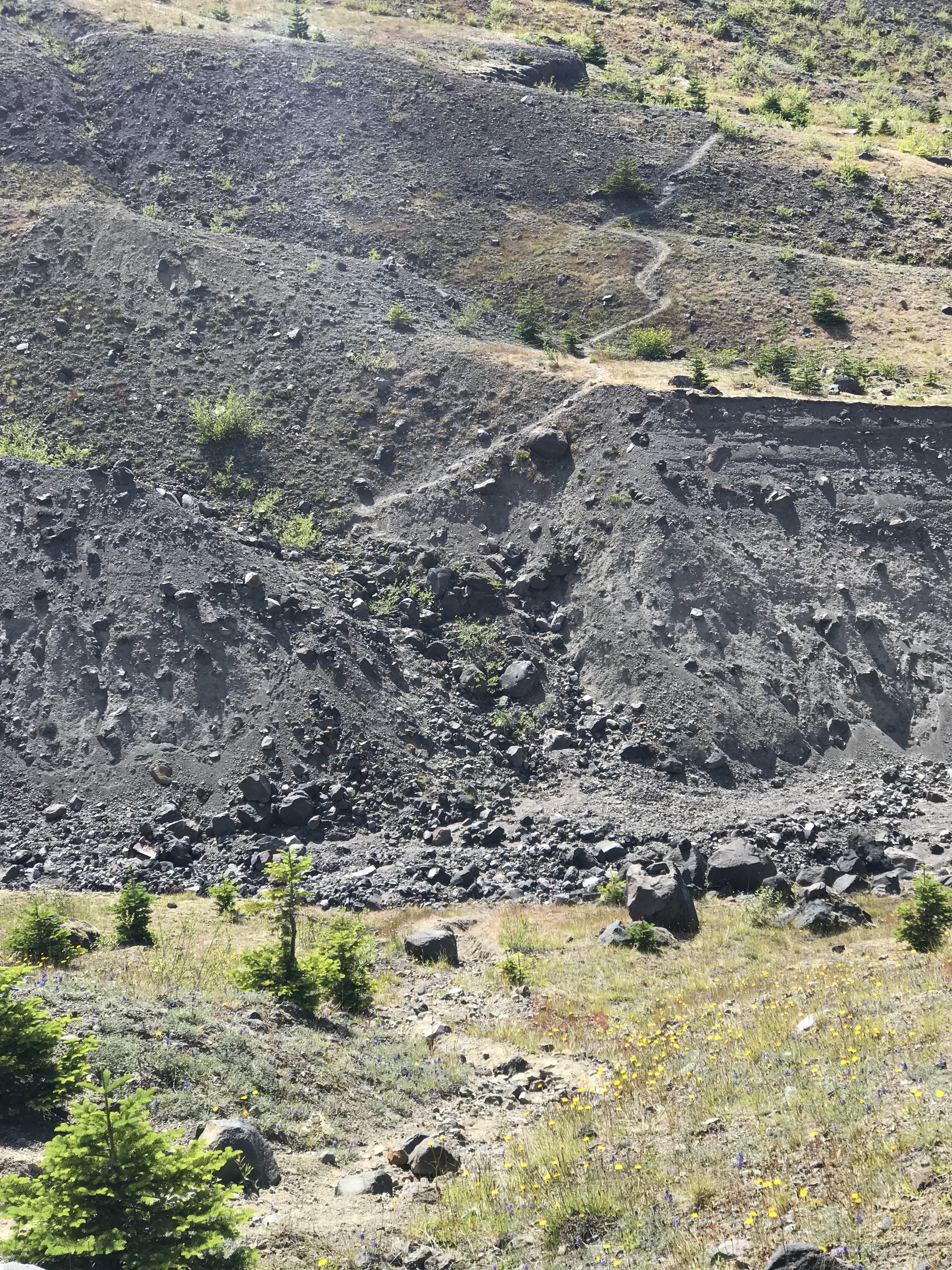
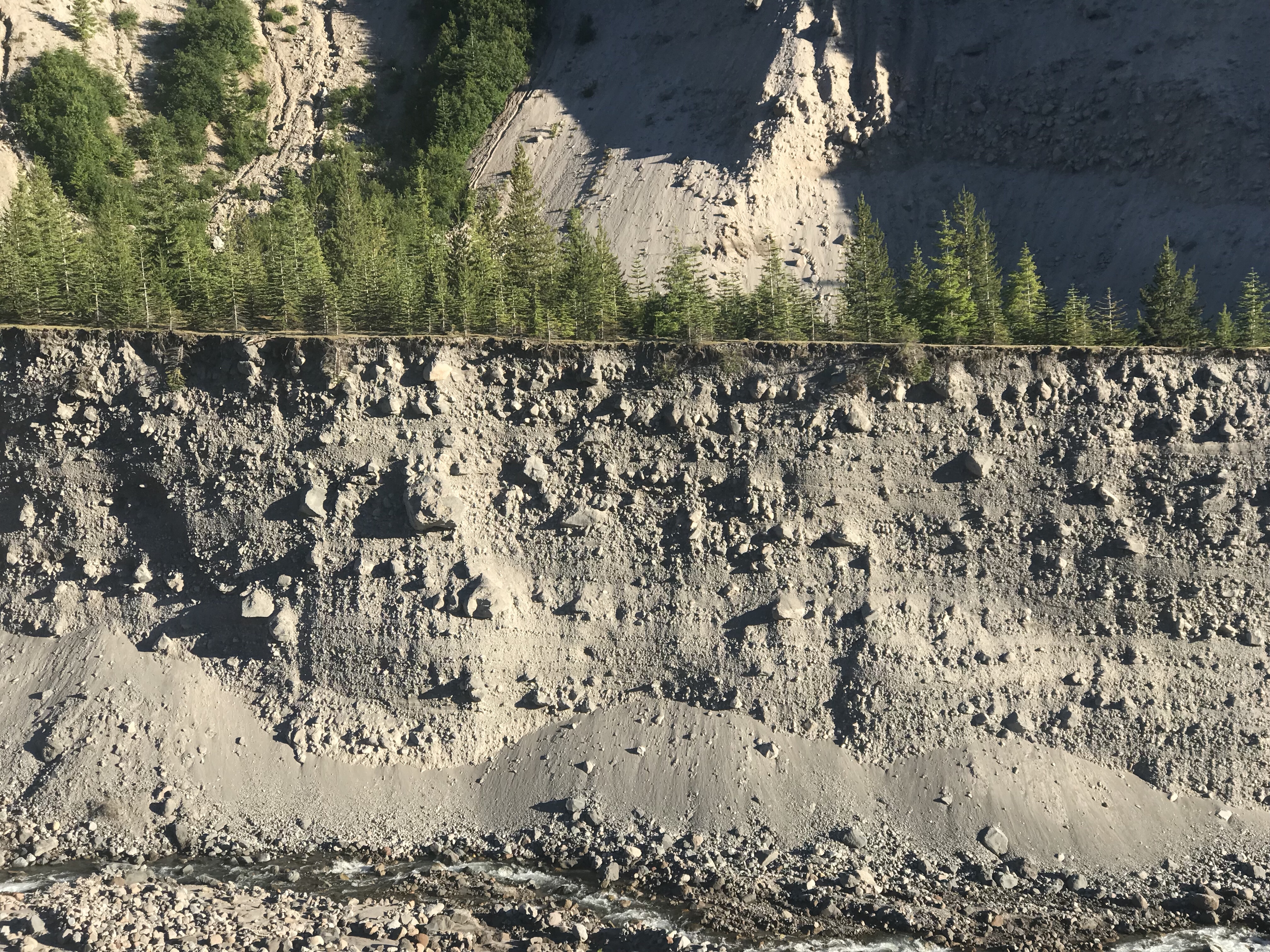
The contrast between the start of the Washington PCT and this trail could not have been higher. The effects of Mt St. Helens’ eruption now over 30 years later is still starkly evident. The terrain was – and has been – like walking on the moon:
I think of volcanos as pimples on the crust, but Mt. St. Helens’ post eruption is like a massive regurgitation of magma from what is now a gaping mouth hole of a mountain. The sheer volume of material spewed out explosively is on massive physical scale.
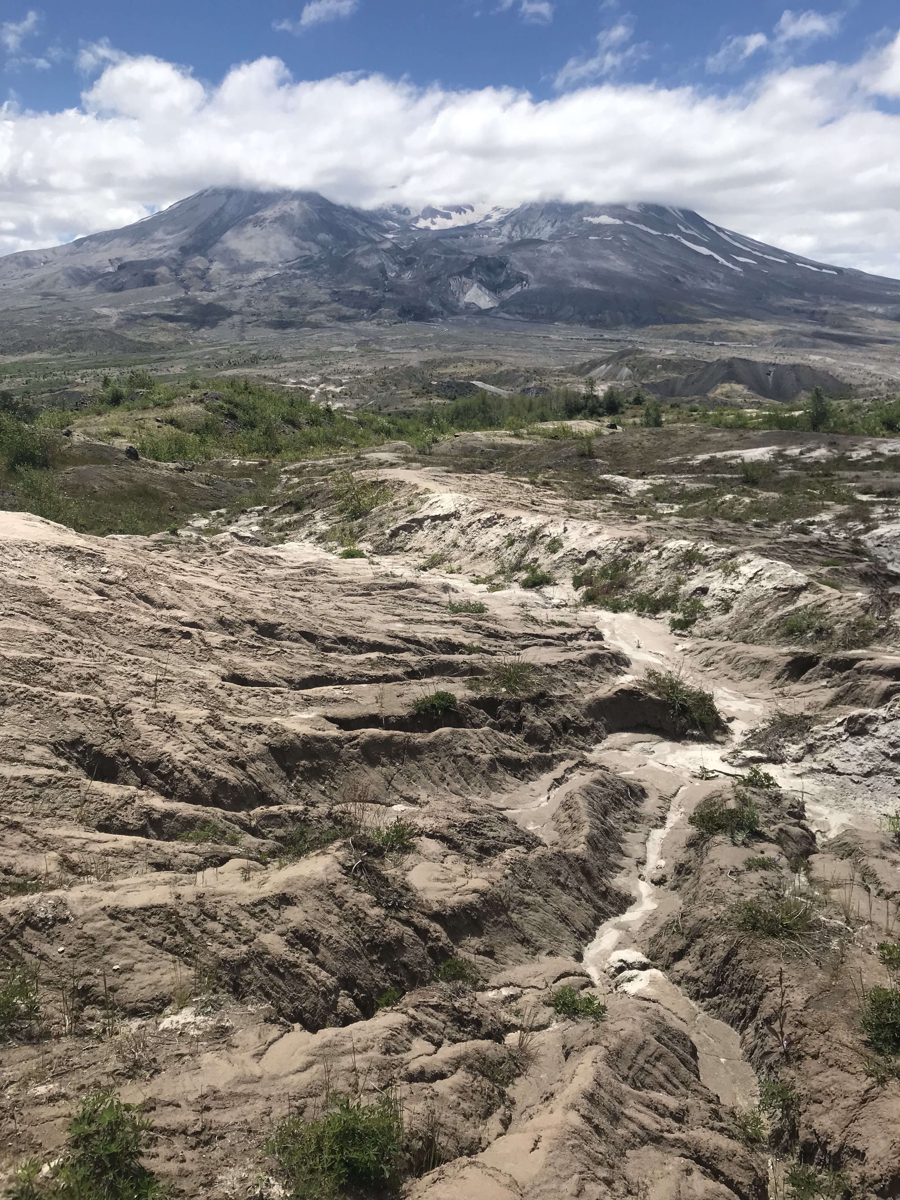
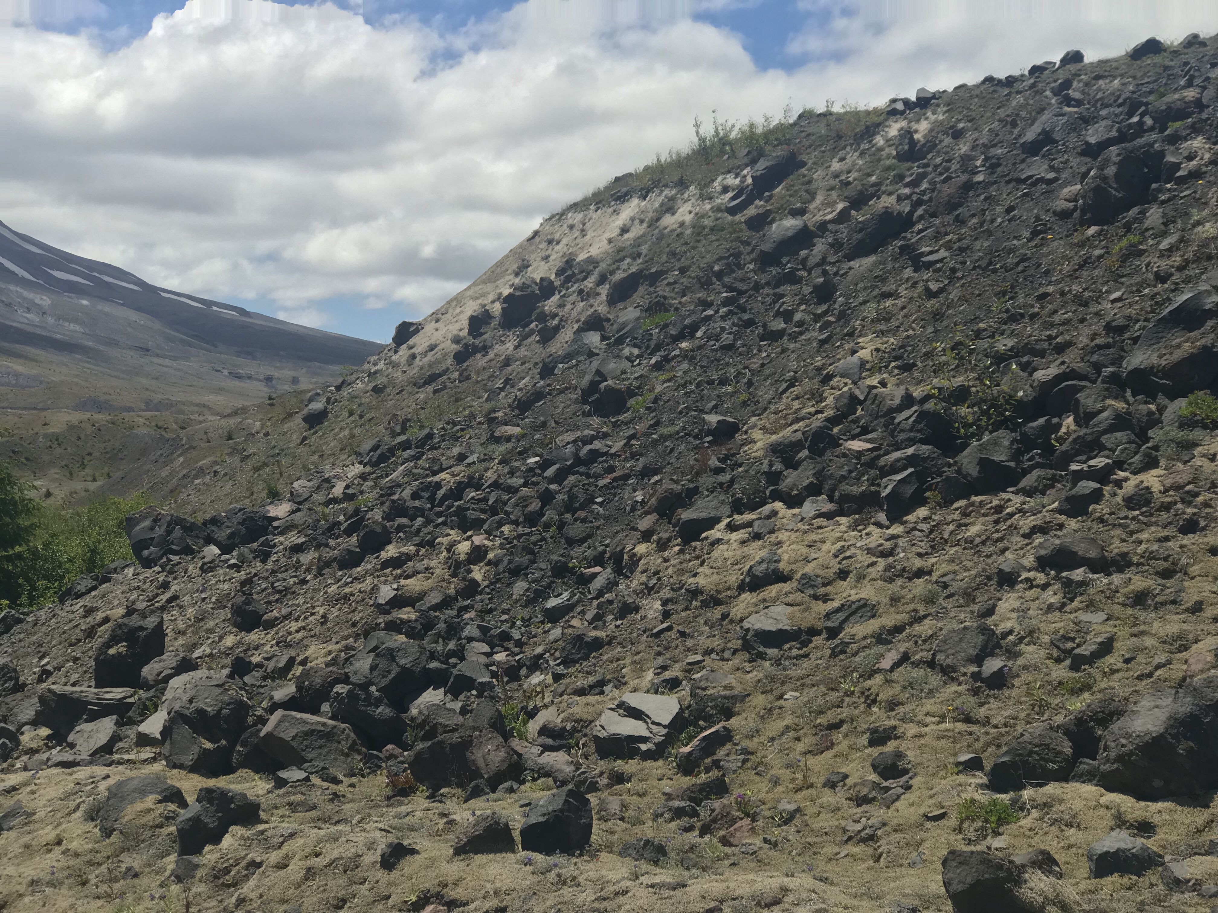
In many places the trail consisted of just clay like mud – and all deposited in the same spot. I struggled to come up with explanations for these deposits in the context of the larger eruption. I learned later that these piles are called hummocks and are remnants of the landslides where large chunks of likewise materials clump together to form unusual mounds. It wasn’t until the Mt. St. Helens eruption that they even had an explanation for these mounds that were observed at other volcanos (e.g. Mt. Shasta).
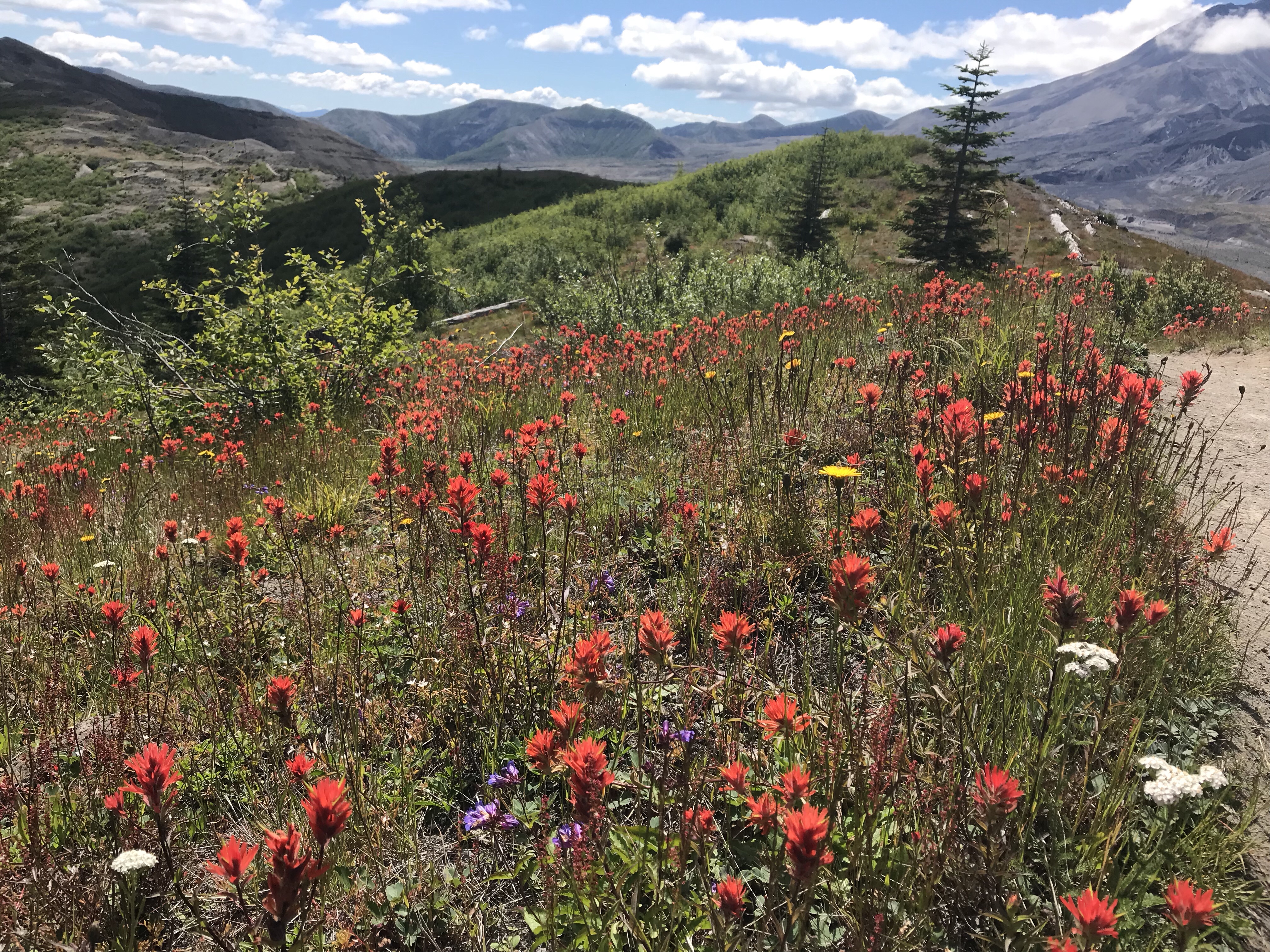
It was not all moon landscape macro destruction. On the micro scale, the landscape was more alive than I’ve ever seen in it in my trips over the years. The blooming Indian Paintbrush were and full force and dominated the hillsides by the JRO.
After passing through the visitor center hikers in the first hour on the trail, I met up with a young but dismissive 25 year old woman returning from her own three day hike around Mt. St. Helens on the Loowit trail. She gave me a few tips:
- There is a Campsite in the trees a half a mile up the trail after passing the Toutle River
- The trek to the Toutle is the sketchiest (she used the word “sketchy” I think about five times to describe what to expect the next four days)
- No snow on the trail
- The second day was the hardest – 17 miles
All good stuff to know. Soon I made the decision to ditch both my bear spray and my ice axe – good bye to 1.75 pounds that I decided I wouldn’t need on this trail. I’d pick them up on the return portion of the leg out to the Loowit circumnavigation trail.
Meanwhile I continued past more hummocks and piles of black rock and pyroclastic and pumice rocks, piled in mounds.
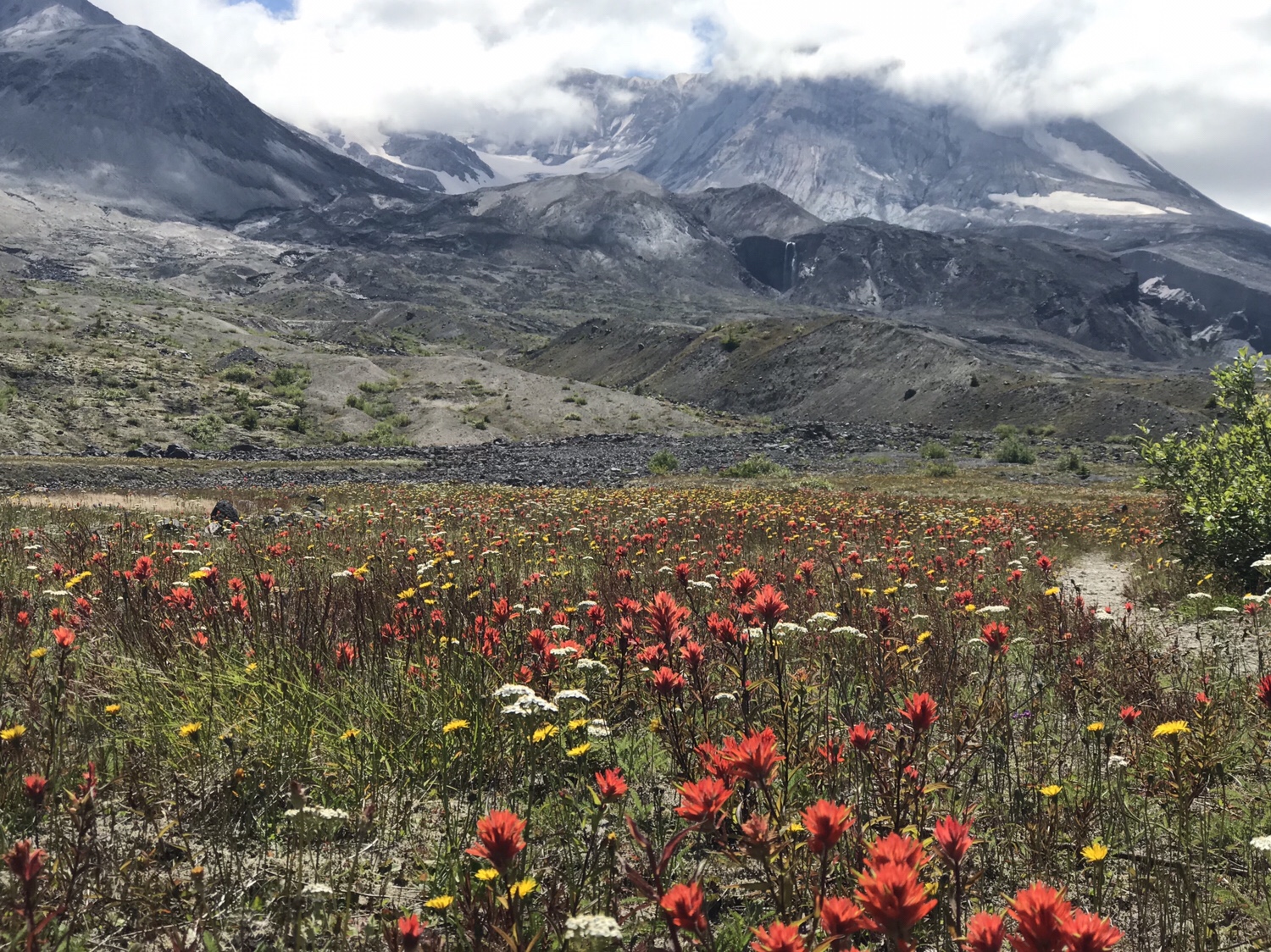
I enjoyed with a smile the fields of red paintbrush, blue lupine and white yarrow in explosive displays of red, white and blue – a much more enjoyable way to celebrate our country’s birthday. I did forget to snap a shot, but here are more of the red and white fireworks:
As I headed further down into the valley of the core blast zone I began to find small stands of alder setting in their roots along new river streams of snow melt. Life was returning further still – from the smallest to the tallest in slow succession.
As I continued on another hour, lo! There on the ground .. sure as could be .. bear scat. Why was I so sure I wouldn’t need the spray?
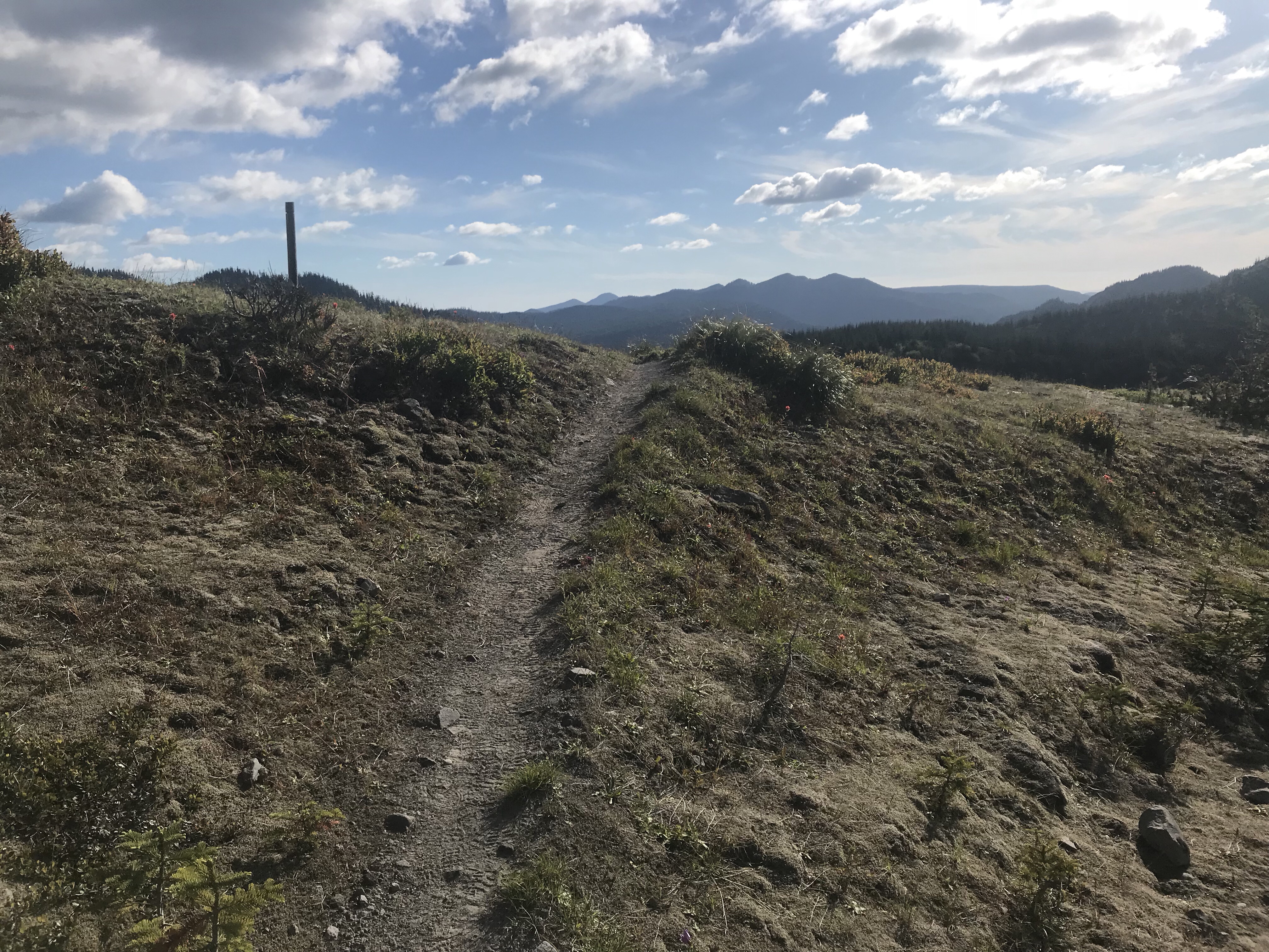
It was hard to be back on a trail with no end, but admittedly a trail that loops over three days was a good compromise. I soon came to the Loowit trail and had a decision to make – to go clockwise or counter clockwise:
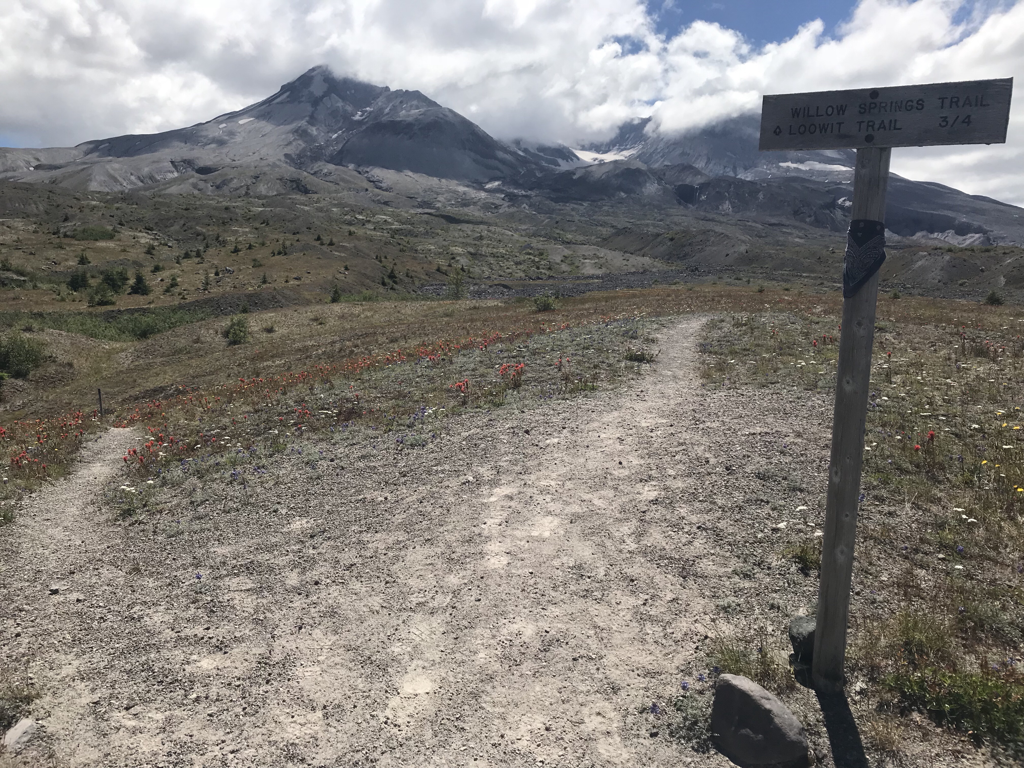
If I went left (clockwise), I’d have a rougher camp site, but it would be closer. If I went right, I’d have to go an extra two miles, cross some of the sketchiest parts of the trail, hit the major Toutle River crossing – but I’d have a good camp spot and would have a greater chance to enjoy views with alpenglow. I went for the gusto and chose counter clockwise. Fields of red paintbrush soon followed as if to confirm I chose the right path.
After another mile, I watched Mt. St. Helens get bigger and bigger in my photos.
Soon enough I came to the realization that I wasn’t looking at Mt. St. Helens – I was now on Mt. St. Helens. It seemed like an apt analogy for dealing with the problem of having trail vision. I love the saying that it’s hard to see the mountain when you are on it. But for trail vision (I.e. being able to see life more clearly when on the trail), it is the opposite – you see more clearly when you really are on The Mountain.
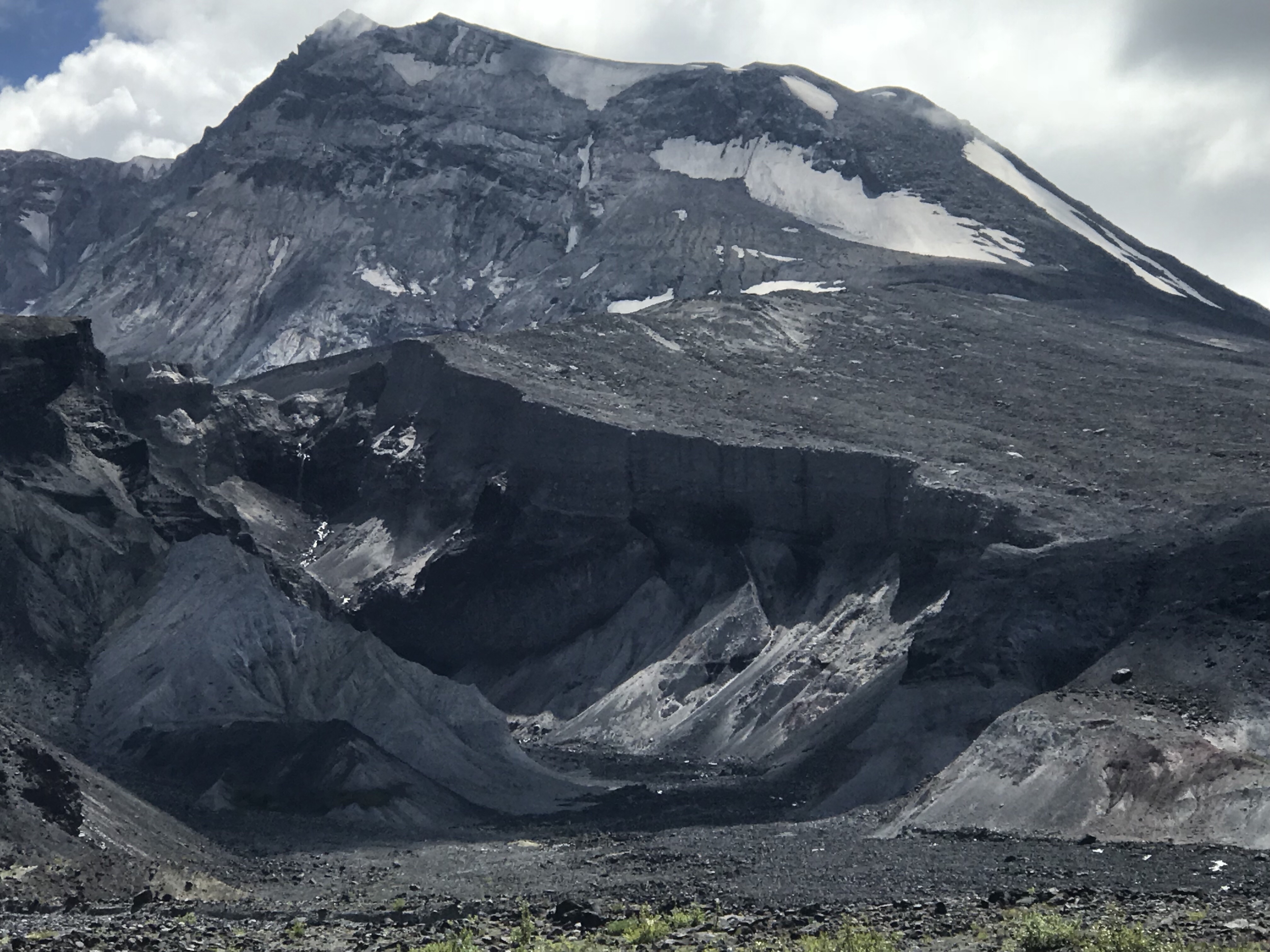
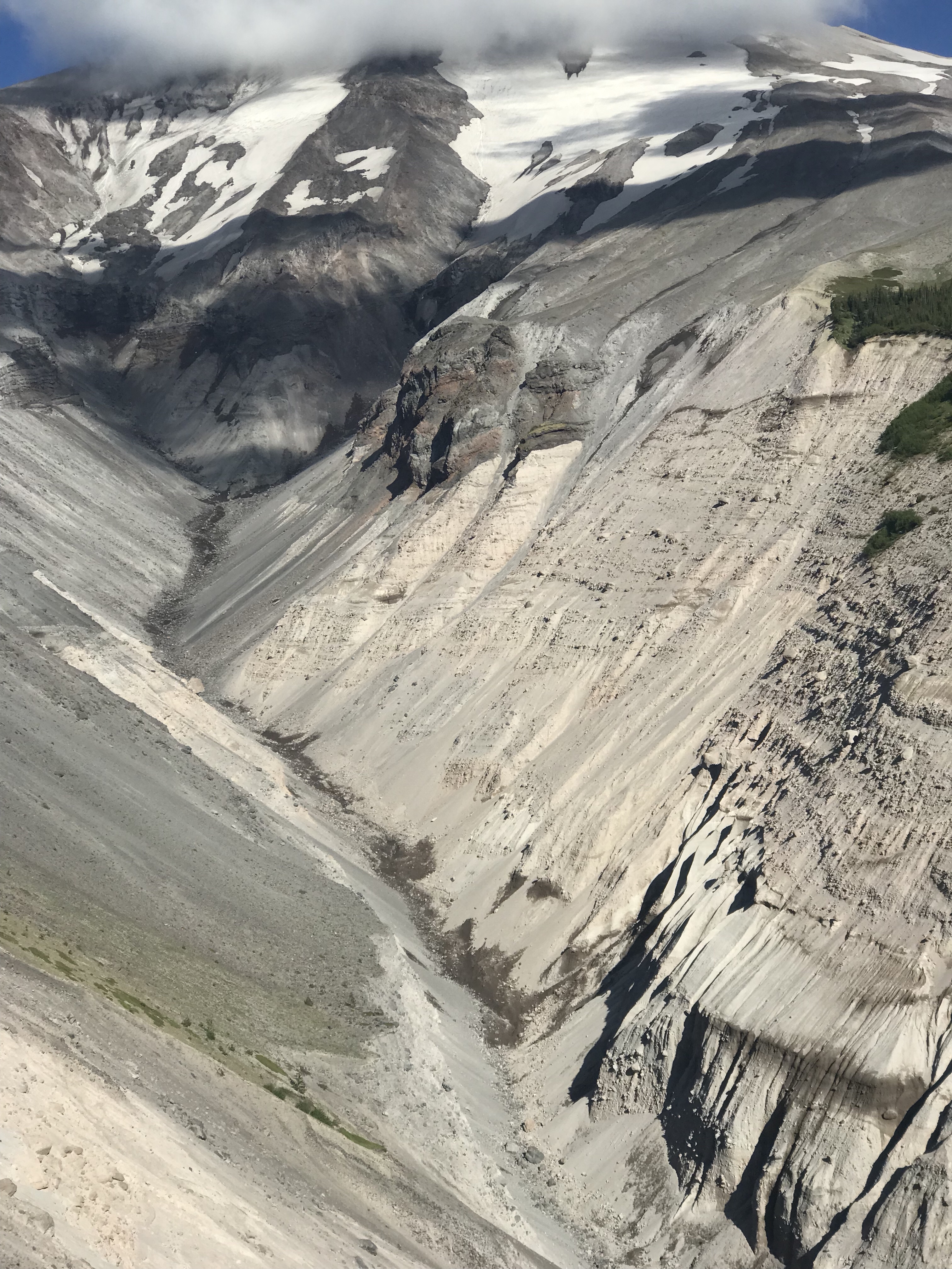
In the shot above you can see the Loowit Falls (a long time dream of mine to see up close) in impressive stance amongst that violent heights of Mt. St. Helens.
The sheer vertical walls of very loose blast material were intimidating even from a distance.
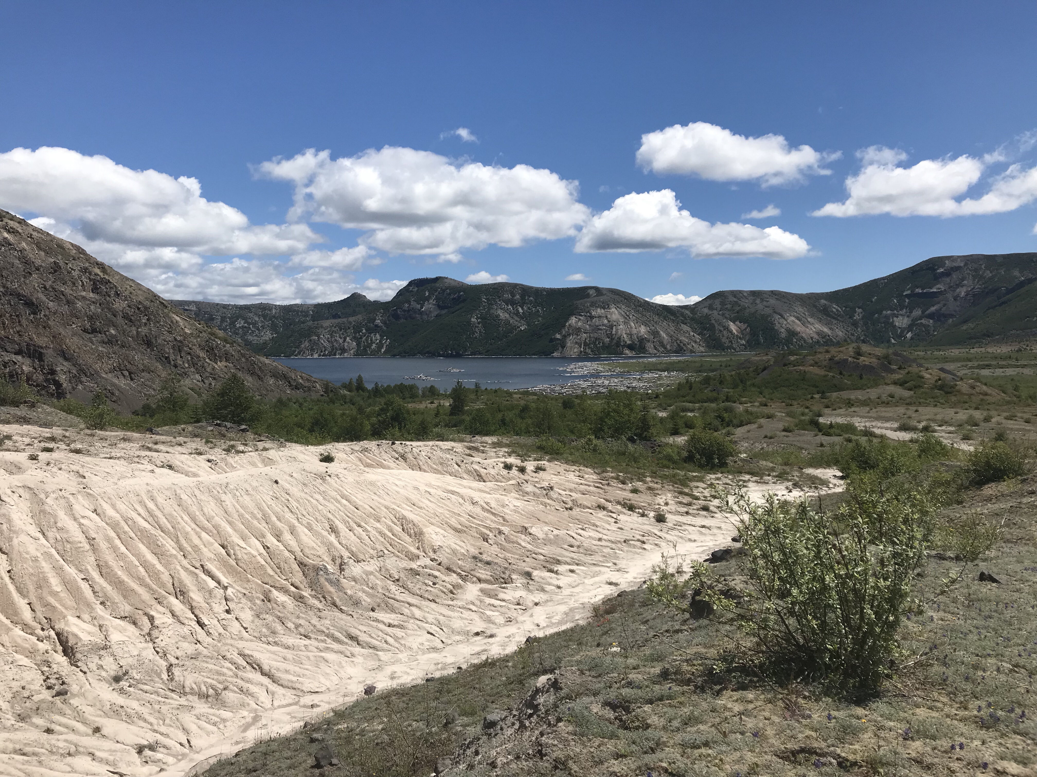
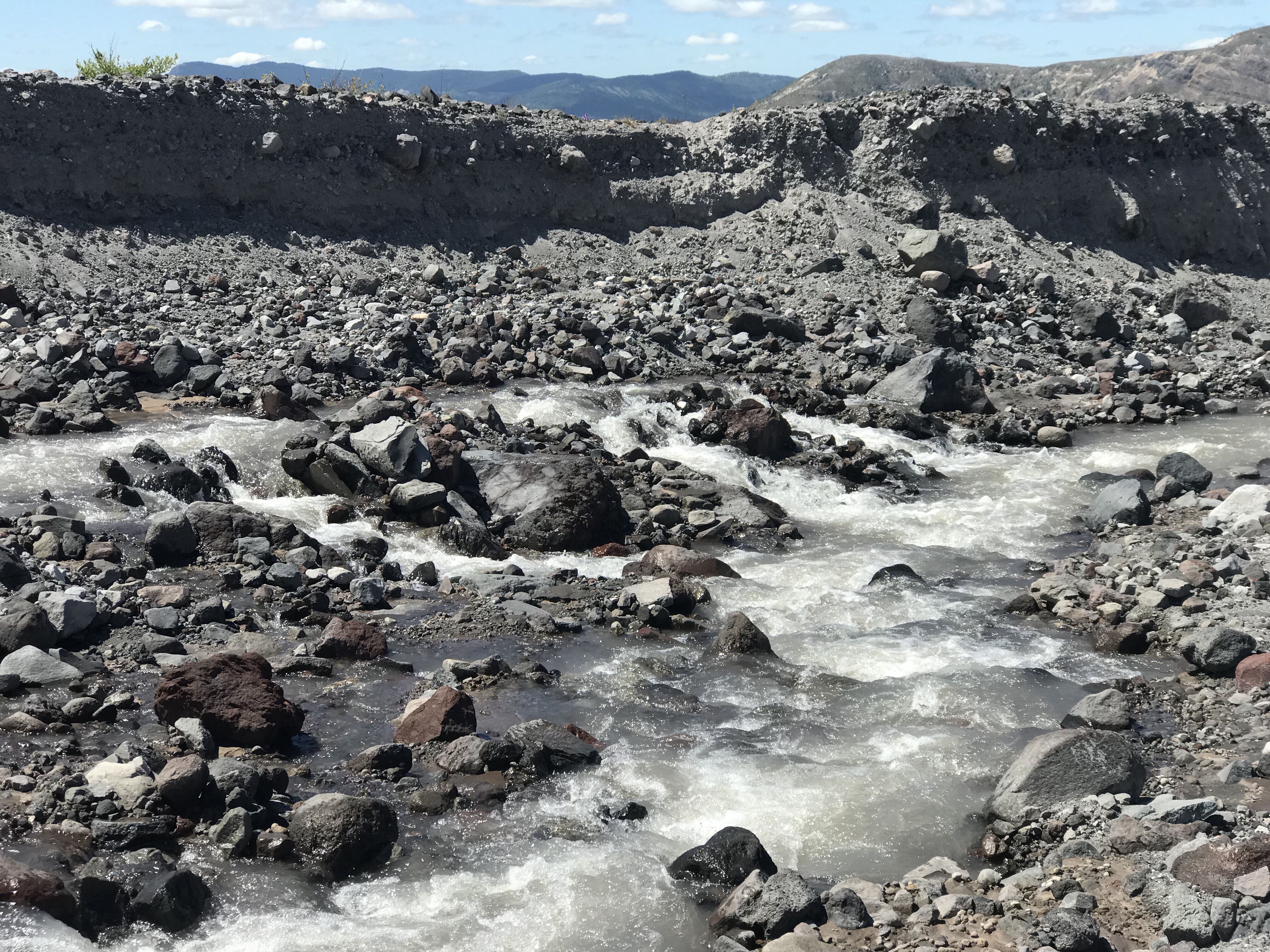
I soon came to my first creek crossing large enough to warrant at least one wet foot.
Soon after I lost the trail. Not that I became lost – rather the trail simply ceased to be as I crossed a massively wide debris field. I met up with a Day runner on the “trail” picking her way through a 3/4 mile way blanket of rubble.
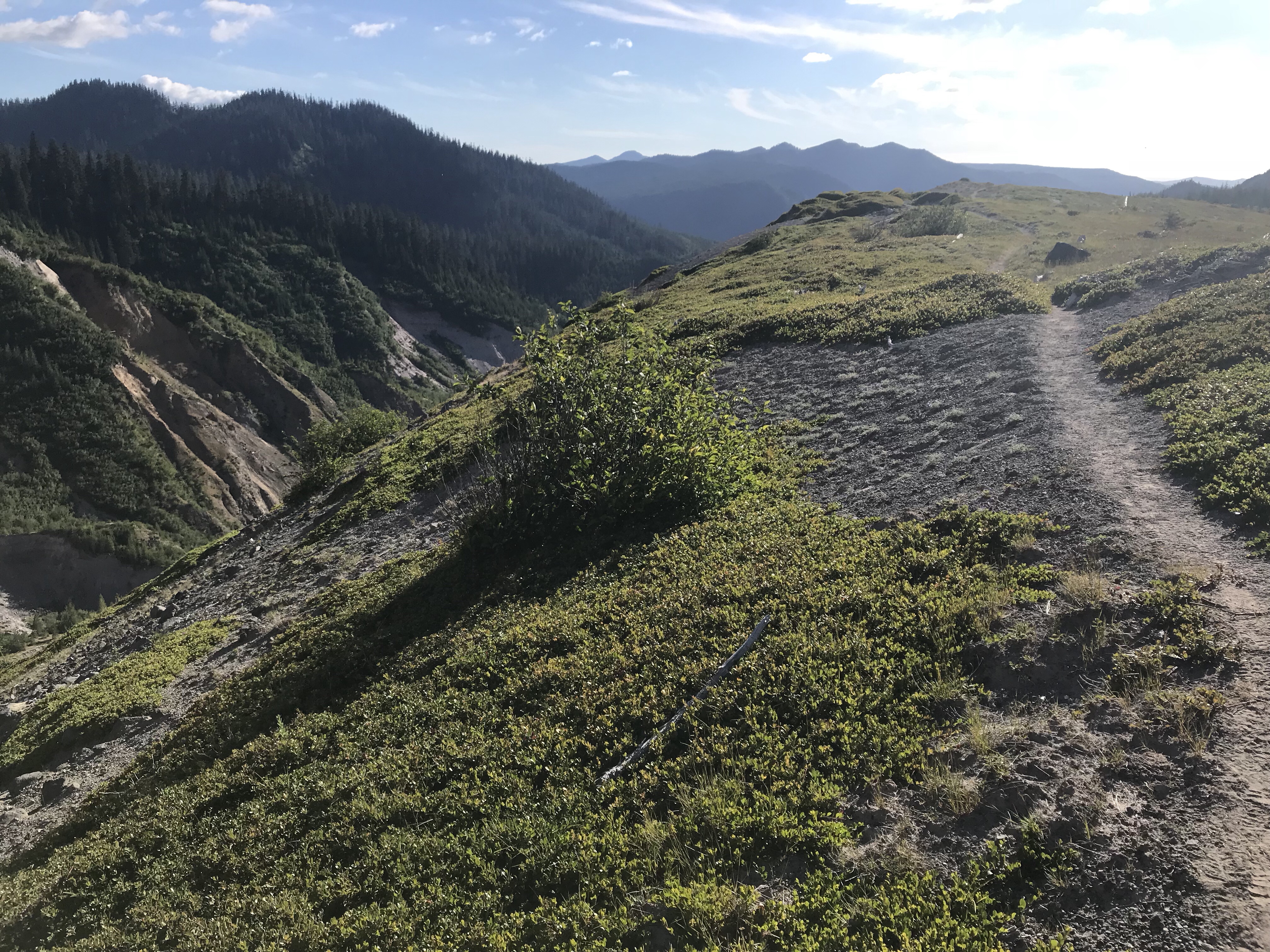
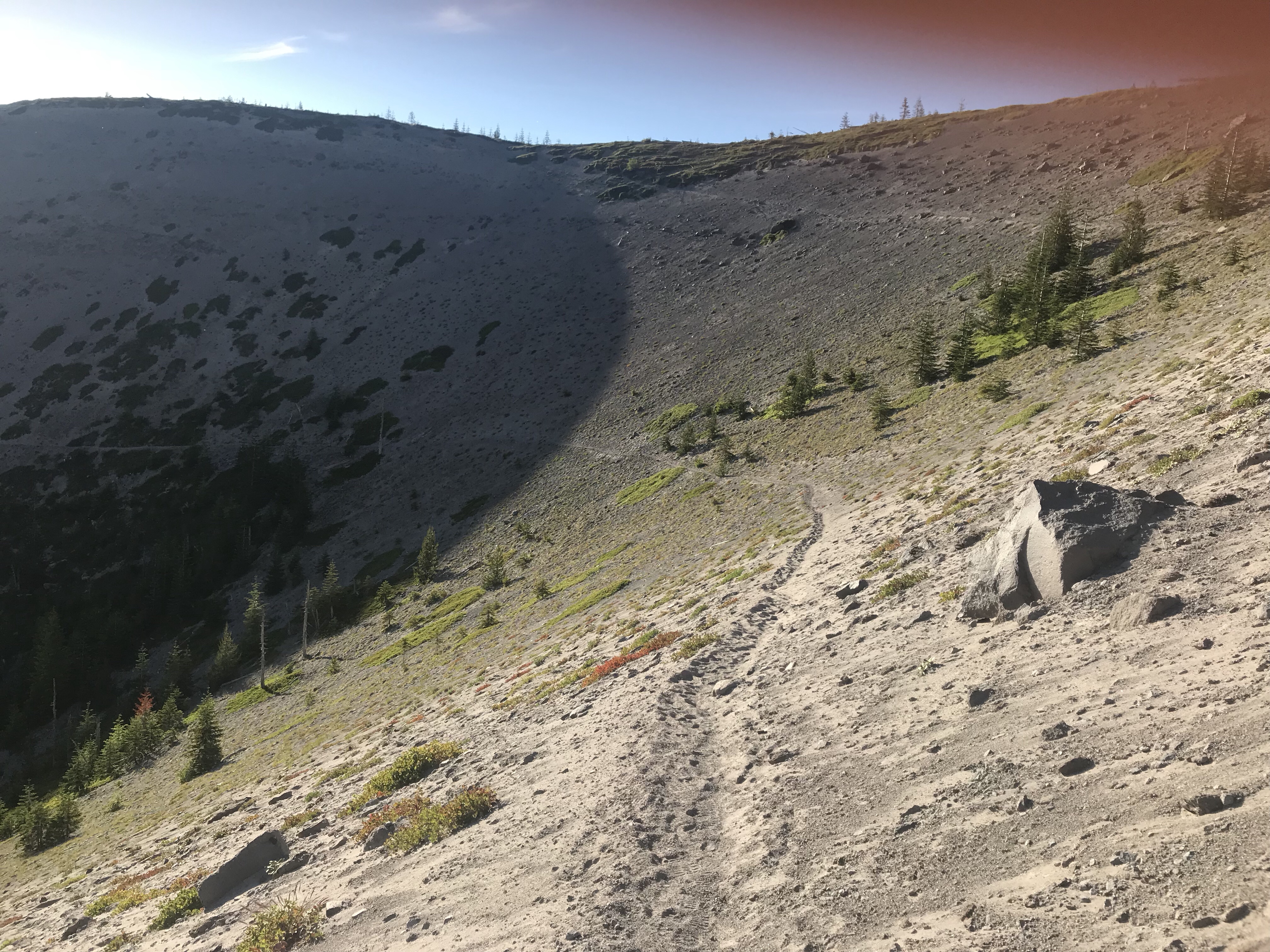
I eventually found the trail again as it head upwards .. and so began the gully hopping. That grind of having one gulch after another. And on Mt. St. Helens, the trail through the gulches can be very poorly defined.
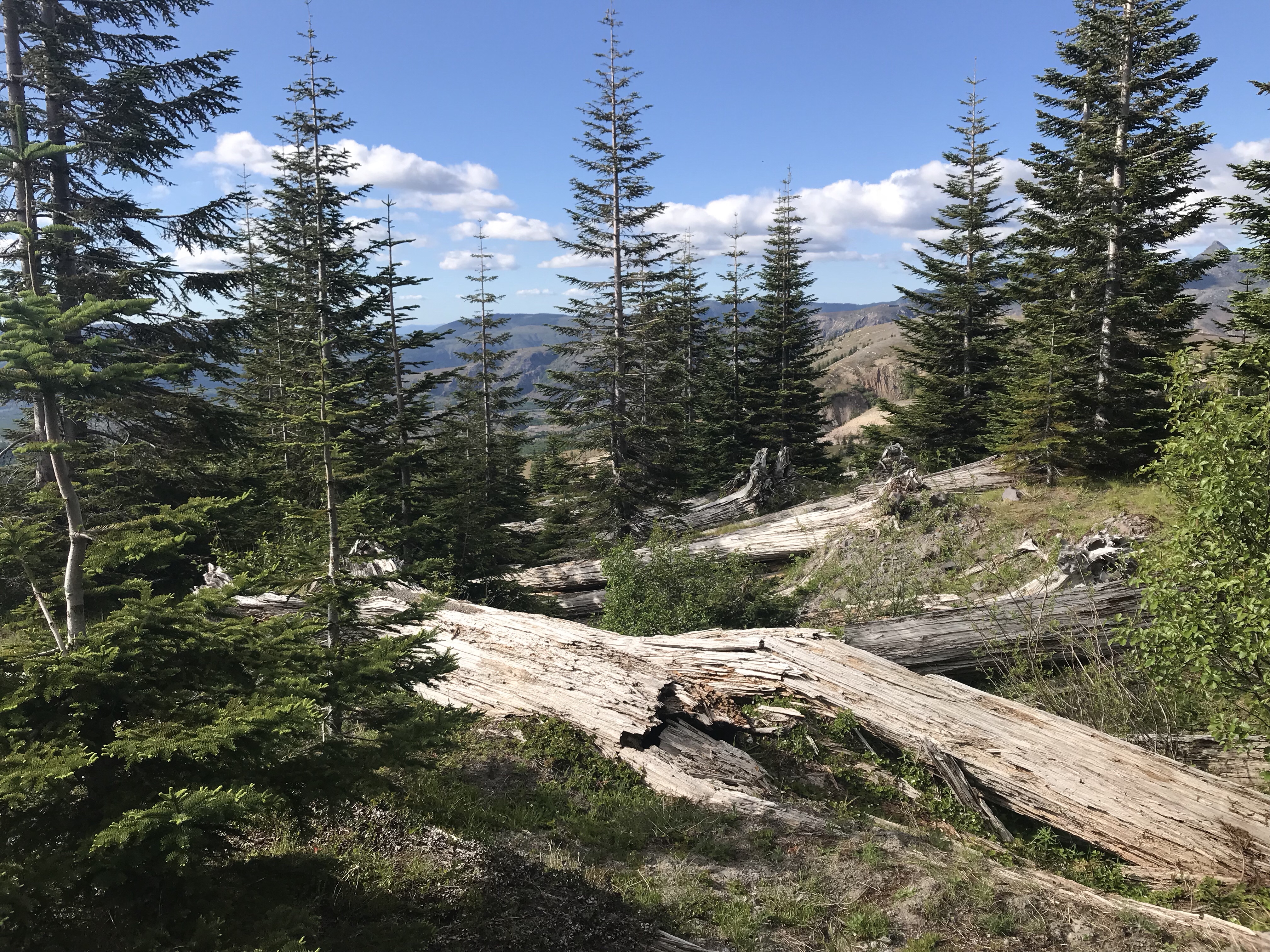
Eventually I passed a corner – just barely on the edge of the primary blast that scoured the surface clean with a mixture of hot gas, pyroclastic blasts, and a massive landslide. And there – on the edge, I found a soft mat of life – including the first sign of grass – living around the trail. And evergreens too, making their first initial forays into reclaiming the blast zone as their own.

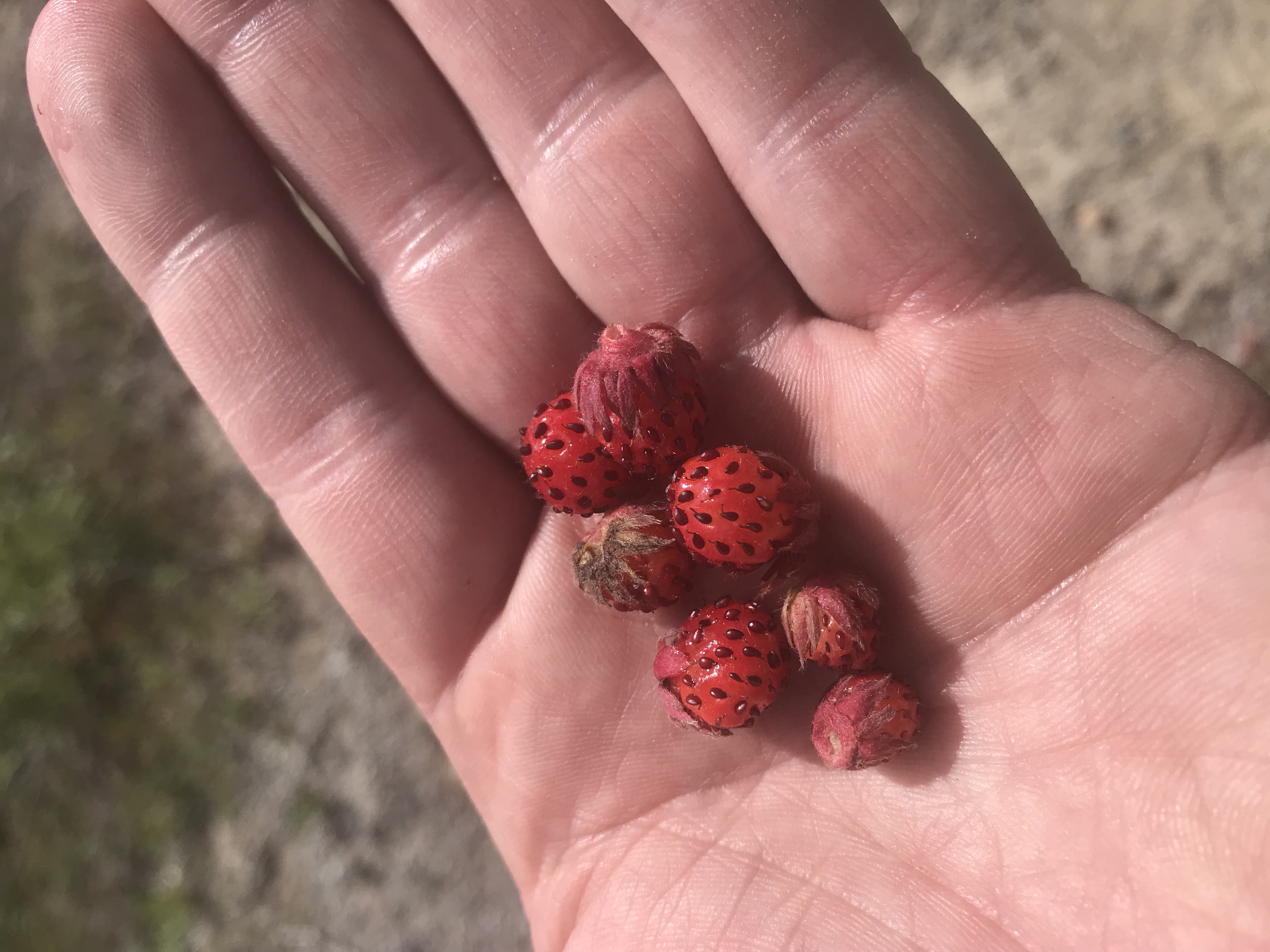
I also discovered wild strawberries reaching ripeness – what a special delight! I enjoyed their sweet concentrated flavor, bolstering my spirits further.
The trail continued on..
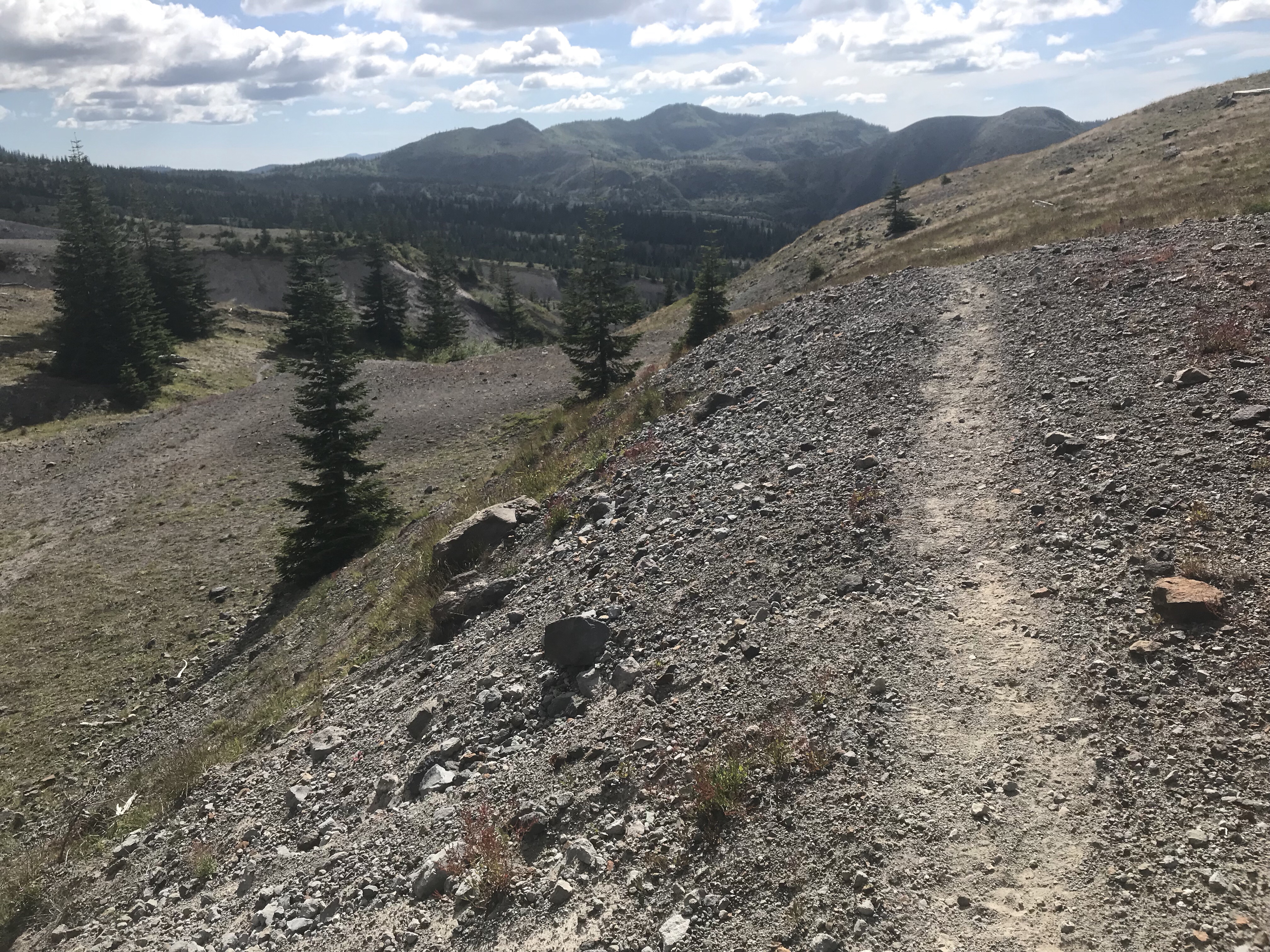
And so did the gulch ravines in ever increasing form:
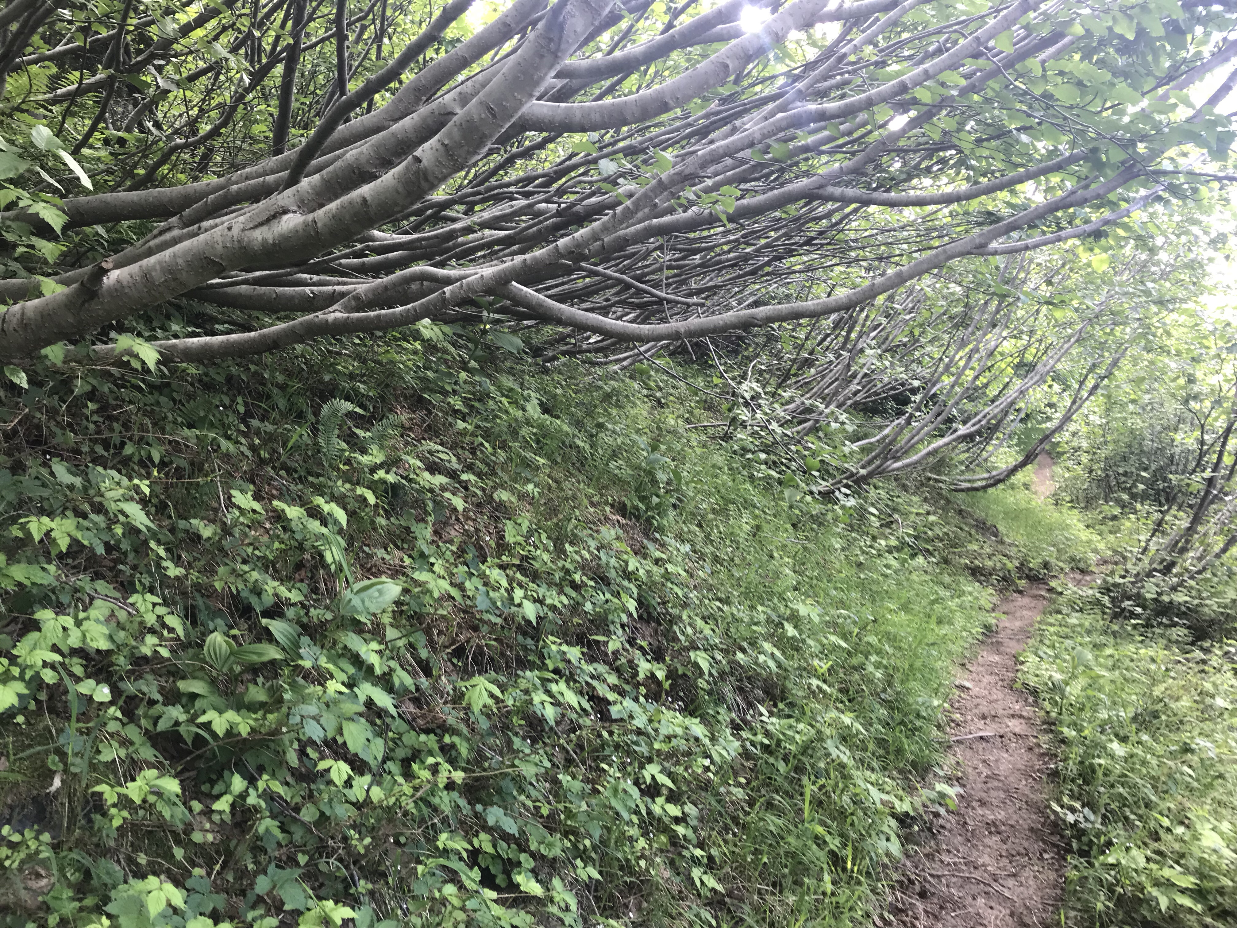
I turned another small degrees of a bend away from the blast zone and was confronted with a few even thicker stands of alder – gone horizontal presumable from the weight of snow.
And here, on this side, the strawberries were just in bloom. What a difference just a few degrees around the mountain make. Evergreen trees were now becoming spotty and were growing where protected stands of tree skeletons from the blast laid up in parallel. You can always find the blast point – as all the surviving tree blow downs point to the blast like magnetic compass arrows:
I also saw my first snow on the trail.
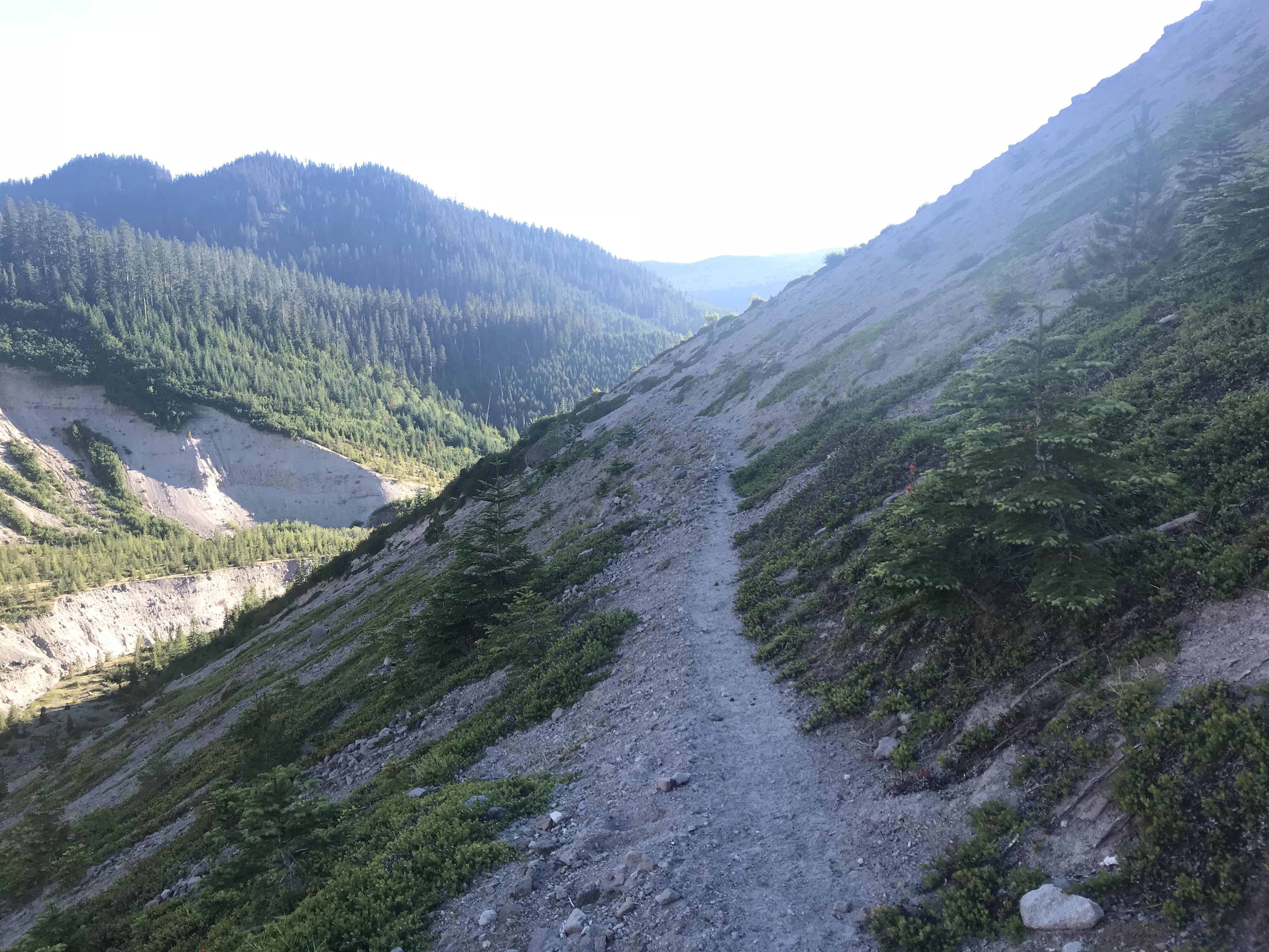
And so the trail continued. I had to keep going for camping was not allowed in the delicate regrow the region known as “the blast zone”. I wouldn’t reach that edge until I hit the Toutle River.
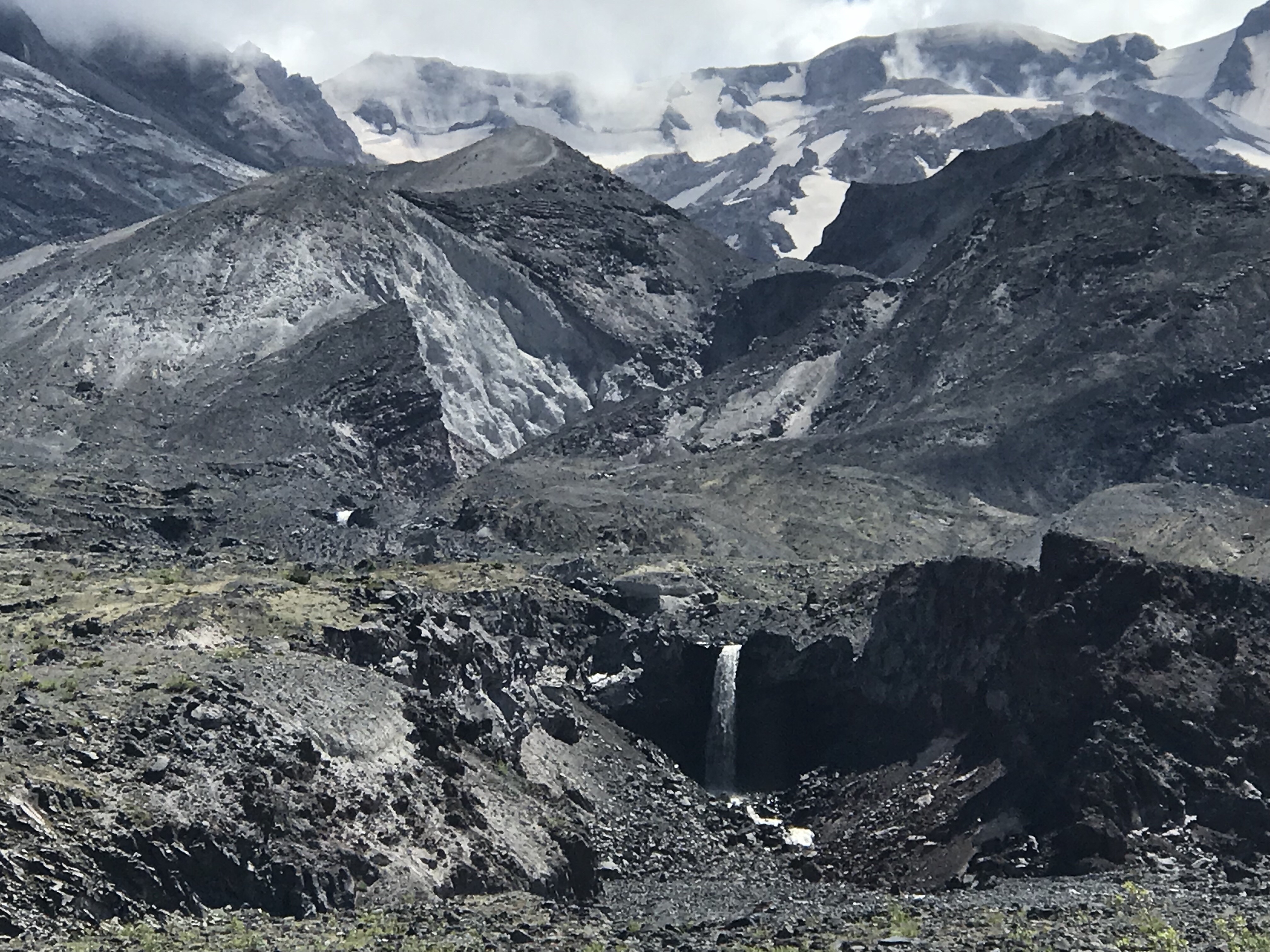
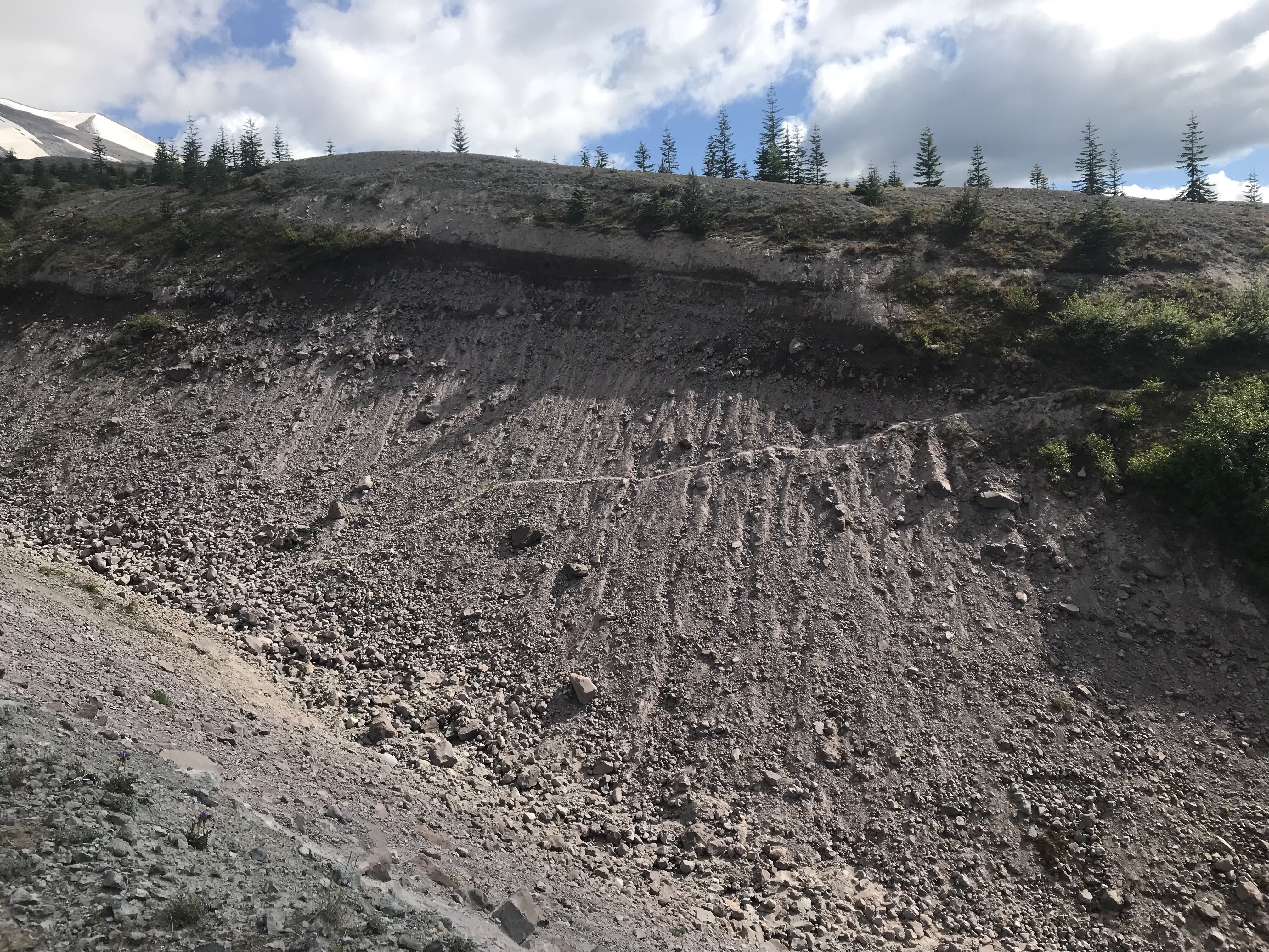
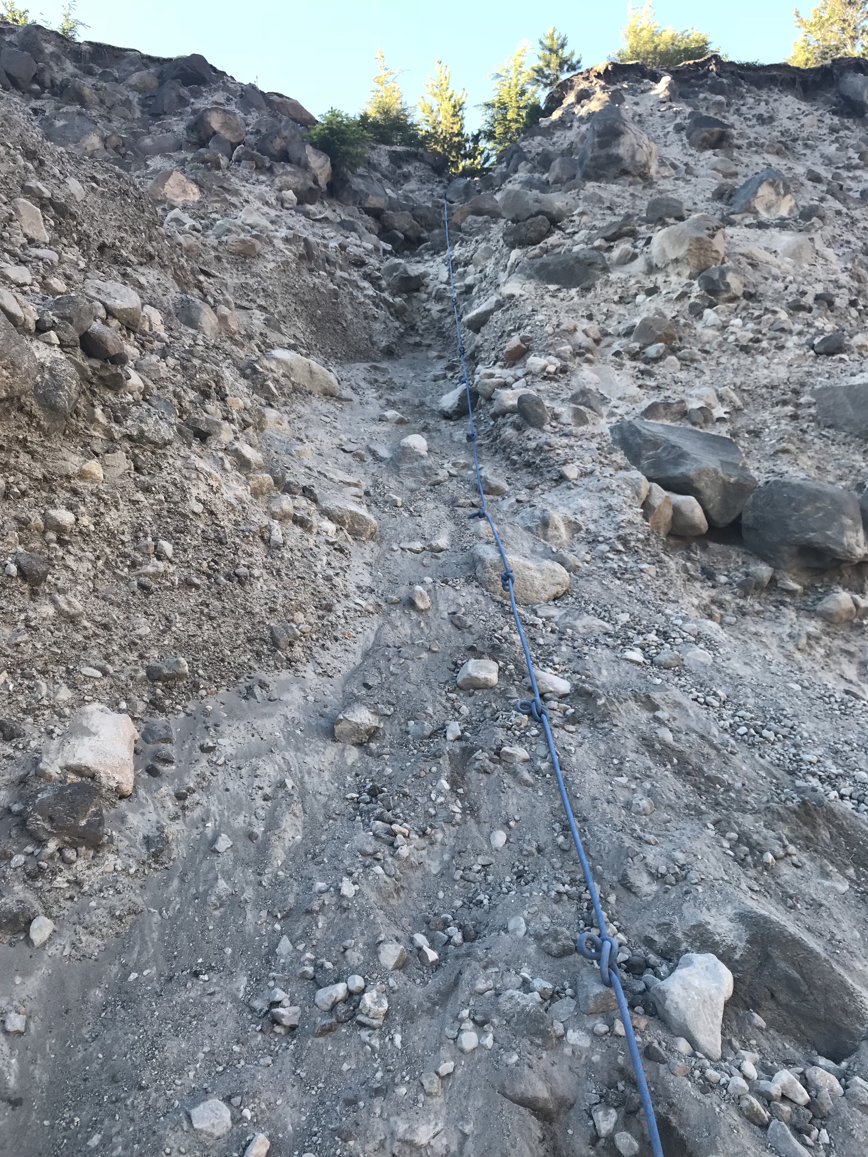
Until at last – there she was. The grandaddy of ravine crossings on Mt. St. Helens: the Toutle River gully.
Every thirty seconds you could see and hear a rock slide somewhere in the view – this was a landscape in active erosion. This continuous frightening sound of rocks tumbling would continue for the rest of the day hence forward. Here is smoke from one such slide as I came to the lip of the ravine.
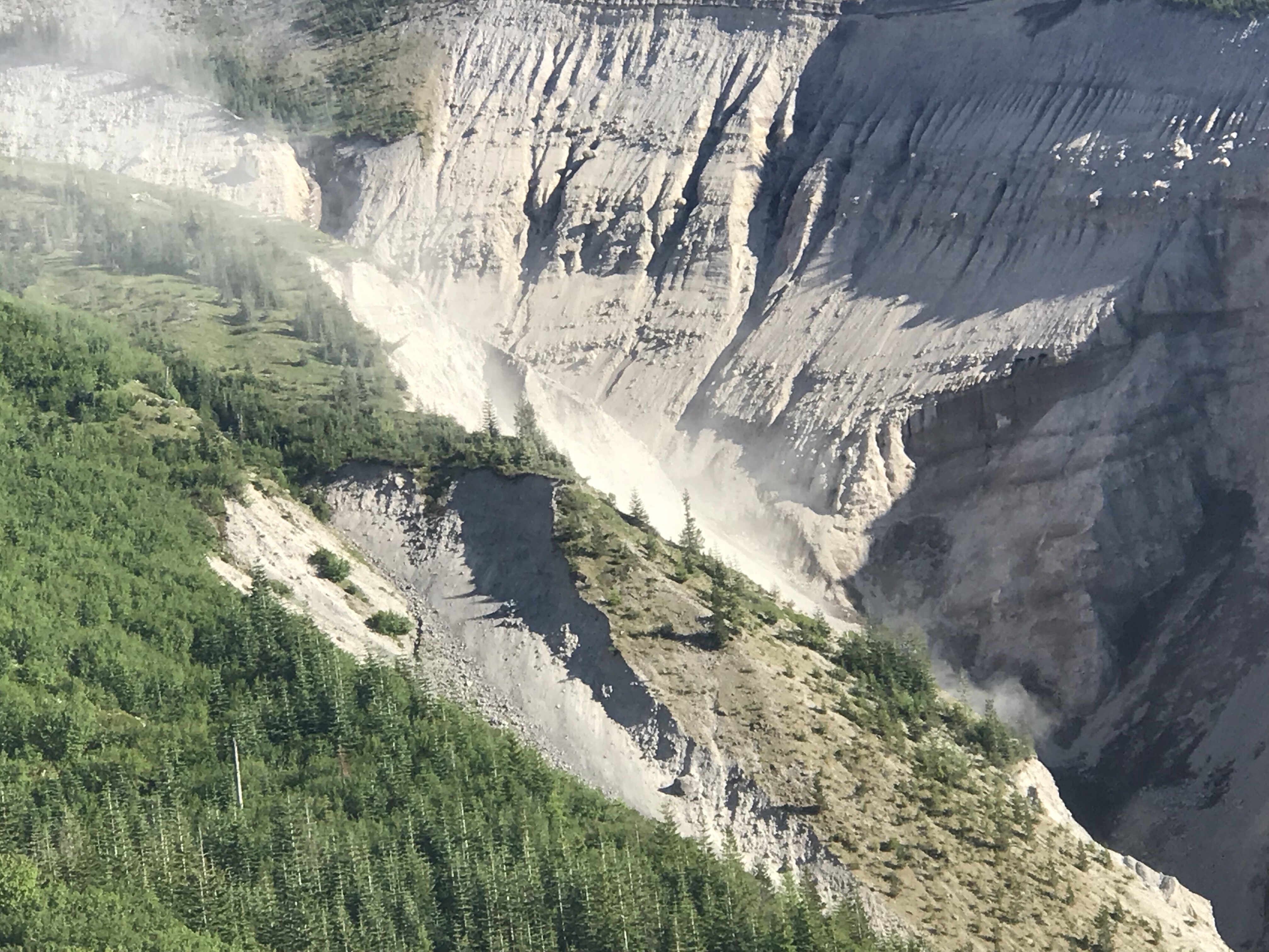
You could also see – for the first time – stands of trees that somehow had survived that massive eruption just around the bend of the mountain.
The trail headed downstream, but following the ridge line as if it was delaying the inevitable pain that would come from going over the lip.
Finally it pitched over the edge and into fire. I fueled up on a peanut butter tortilla and took the delicate plunge.
Sadly terror is never captured in pixels. A heart wrenching 45 degree slope with a trail that at times was one step wide translates to a gentle slope with a waning shadow as the sun peaked below the edge.
But yes, at the end of a long day the trail was a challenge, and you knew that if you slipped, you’d only accelerate as you fell the distance.
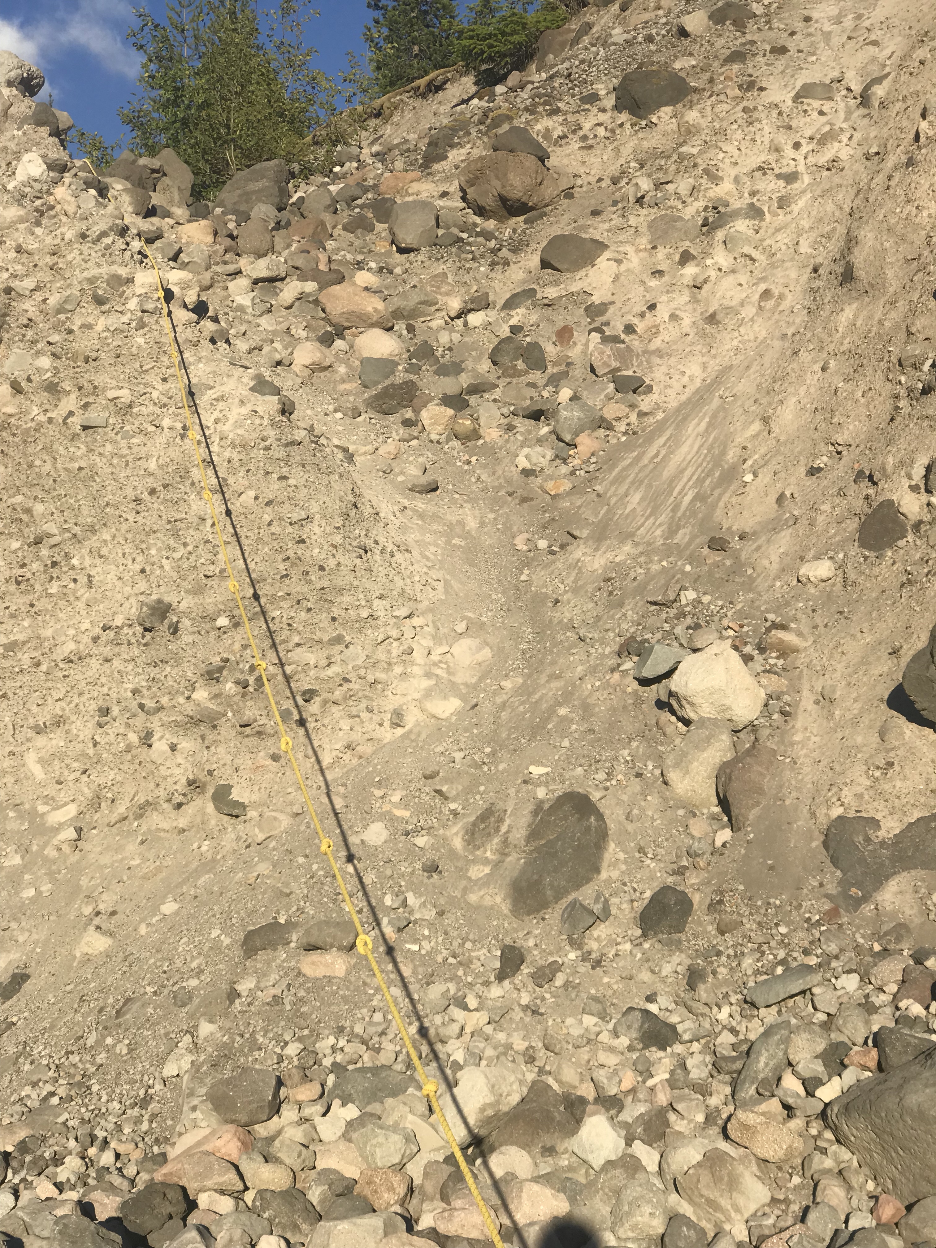
After a soothing duck into a slope thicket that calm the nerves, I made it to the final, most active erosion area of the river. Peering to the other side, this is what it looked like – and train your brain with scale by realizing some of those trees are > 25 feet high.
To help hikers get through this hurdle, I found the thing I read about before the trip that I had been dreading.
Yup – to get down, you had to travel by rope. Fun and risky without a 40 pound pack. Terrifying and courage testing with one. But in the end, they actually were quite lovely. They made the travel far easier than some of the previous ravines despite being far more difficult to go down (including about a 6 foot overhang drop with no foot holds). What was I so worried about?
I refilled my water and then went up two more ropes to get you past the first part on the other side. (Again, photos are deceiving – this next one is looking straight up – notice the orientation with the trees to get your brain to realize in 3D that you just can’t simply walk up this slope)
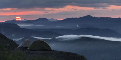
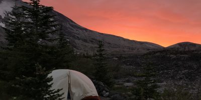
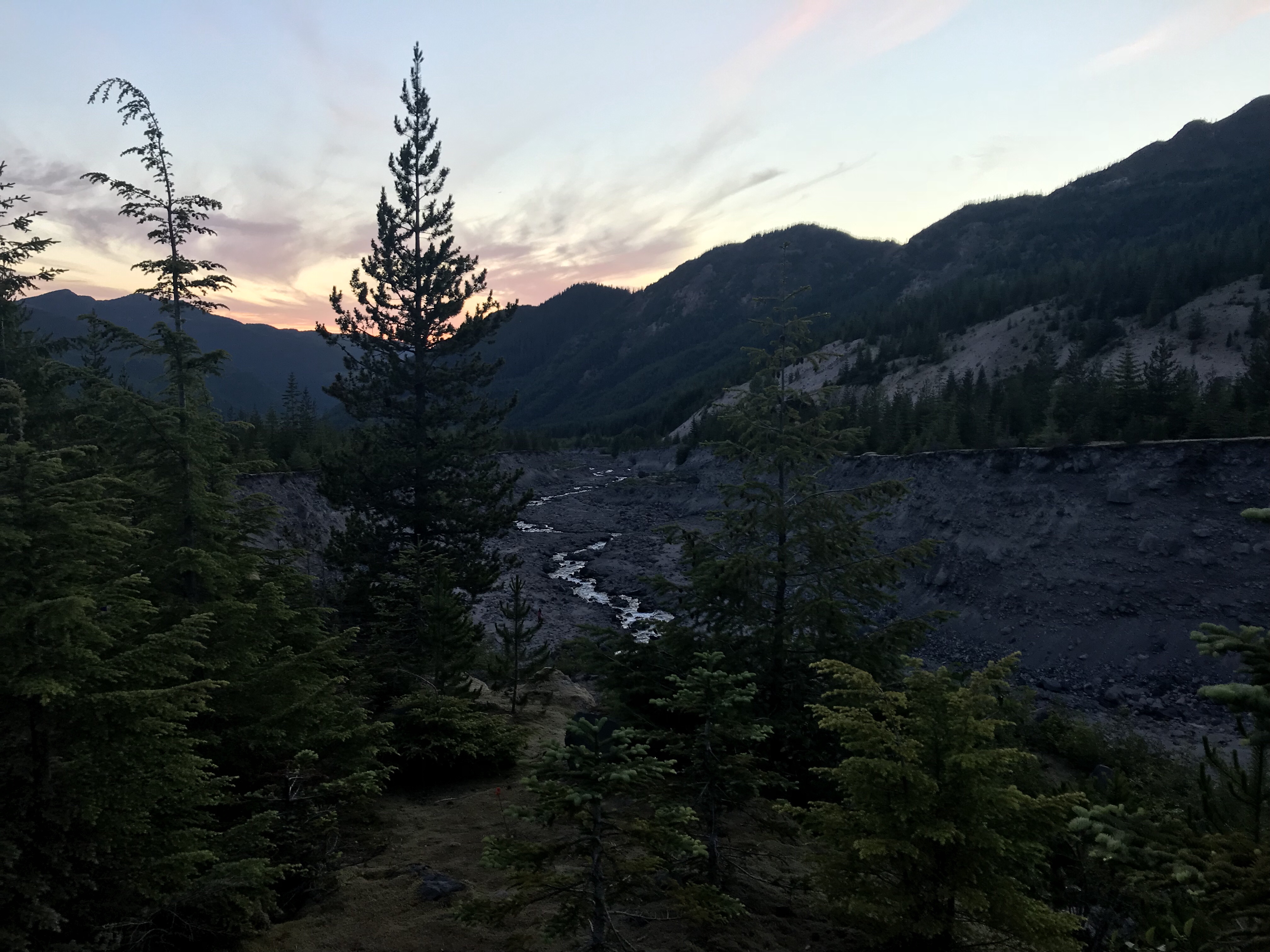
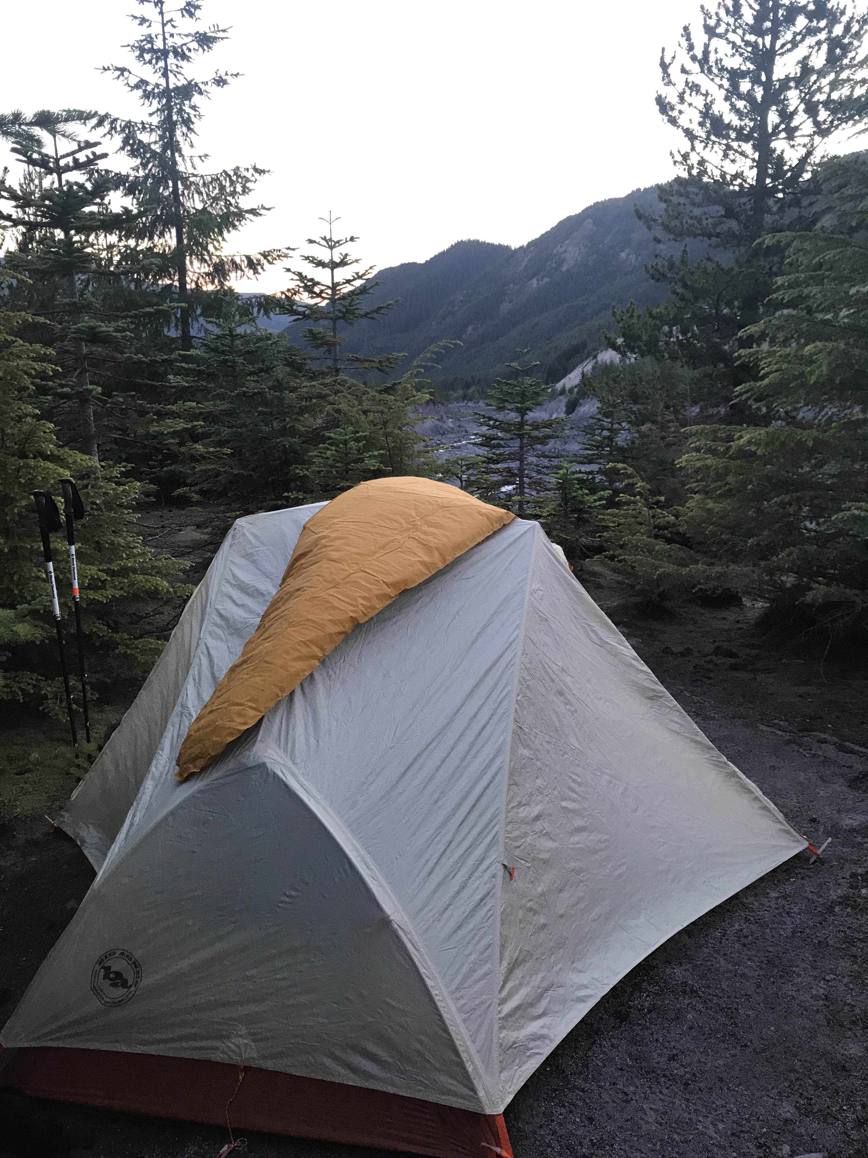
Having cleared the blast zone, I made camp in an area that was shared by a few others just as the sun was setting and alpenglow reached the mountain.
At camp, I made all the rookie mistakes from first night in the woods all over again. I spilt over half my dinner (travesty!) into the most carpet I was eating on, to which I recovered what I could. I spilt water all over while pouring it (didn’t I already learn that lesson?) I didn’t get the burner started while I was making my tent, delaying dinner. I didn’t even go pee before bed – making for a fitful night. I harked back to the adjustment period and laughed at my tiny misfortunes.
I wrote late into the night and enjoyed the stars with occasional peeks from by rain fly – the Big Dipper was right outside my window.
In the end, I felt refreshed from the effort and one step closer to getting my groove back.
Daily Stats:
- FitBit Steps: 38,567
- FitBit Miles: 18.19 Miles
- FitBit Flights of Stairs: 247
- FitBit Calories Burned: 5,660
- Weather: Chilly but Sunny
- iPhone Battery: 100% to 74%
- InReach Battery: 10%
- People Parties Met (after first hour): 5
- Confirmed Loowit hikers: 2
- Wakeup: 6:15 am
- Camp Departure: 7:00 am
- Trail Began: 10:45 am
- Camp Arrival: 8:30 pm
- Sleep Attempted: 11:45 pm
- Camp Co-Inhabitors: 2 parties
- Morning Pack rolls: 2 rolls
- Sorest Body Part: Achilles
- Highlight of the Day: Great show of generosity by David to drive me all the way to Mt. St. Helens
- What did I shed from civilization: the need to talk to make conversation
- Realization of the day: rhythm is the key to living life at the edge of endurance
- Trail tidbit I learned today: every day away from the trail is another day needed to reacclimatize to the trail
Leave a Reply